

Table of Contents
Introduction:
The proposed design is cost-effective, reliable, and has the function of accurate tracking. When large objects or vehicles were spread out over the ground, the owner corporations often found it difficult to keep track of what was happening. They required some type of system to determine where each object was at any given time and for how long it traveled. Also the need for tracking in consumer’s vehicle use to prevent any kind of theft because police can use tracking reports to locate stolen vehicles. GSM and GPS-based tracking systems will provide effective, real-time vehicle location, and reporting. A GPS- GSM-based tracking system will inform where your vehicle is and where it has been, how long it has been. The system uses geographic position and time information from the Global Positioning Satellites. The system has an “Onboard Module” which resides in the vehicle to be tracked. The On-Board module consists of a GPS receiver, a GSM modem, and an ARM processor. It can provide telemonitoring and management systems for inter-cities vehicles such as taxis and buses. During vehicle motion, its real-time parameters such as location are reported by SMS message. The system takes advantage of wireless technology in providing a powerful management transportation engine. The use of GSM and GPS technologies allows the system to track vehicles and provides the most up-to-date information about ongoing trips. This system finds its application in real-time traffic surveillance. It could be used as a valuable tool for real-time traveler information, congestion monitoring, and system evaluation. An intelligent, automated vehicle tracking system can resolve the following problems such as late arrivals to scheduled, improper use of company time and resources, unsafe driving habits, assigned routes, inefficient dispatching, and passenger dissatisfaction. This can lead to better traffic flow modeling and a better understanding of driver behavior. This project includes various features like ingenuity, simplicity of design, and easy implementation. It is completely integrated so that once it is implemented in all vehicles, then it is easy to track vehicles at any time. Using these technologies we are going to use this system in industries to track the materials.

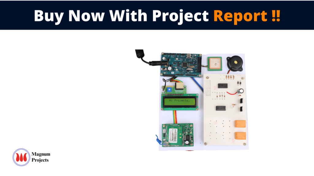
Block diagram explanation:
Power supply unit:
This section needs two voltages viz., +12 V & +5 V, as working voltages. Hence specially designed power supply is constructed to get regulated power supplies.
ARM LPC 2148:
ARM7TDMI processor in our model due to its advanced features described below. 32-bit ARM processor is the contemporary general-purpose microprocessor on the embedded market used in industrial-level applications. ARM7 consists of several peripherals interfaced with it. We use a keypad matrix, LCD, UARTS, GPIO, and I2C protocol. ARM7 processor is a link between GPS and GSM modules for communication.
GSM:
GSM Shield (SIM 900a): The SIM900 which is a complete Quad-band GSM/GPRS solution comes in a SMT module that can be embedded in customer applications. Featuring an industry-standard interface, the SIM900 delivers GSM/GPRS 850/900/1800/1900MHz performance for Data, voice, SMS, and Fax in a small form factor and with low power consumption. SIM900 can fit almost all the space requirements in the M2M application with dimensions of 24mm x 24mm x 3 mm. SIM900 is designed with a very powerful single-chip processor integrating AMR926EJ-S core. Quad-band GSM/GPRS module with a size of 24mmx24mmx3mm, SMT type suit for customer application, An embedded Powerful TCP/IP protocol stack Based upon the mature and field-proven platform, backed up by our support service, from definition to design and production.
NOTE: Modem may change.
GPS module:
This is a GPS Receiver (5V Serial) with high gain having 4 Pin 2.54mm pitch strip. The third-generation POT (Patch Antenna on Top) is used by the receiver for the GPS module. It can be interfaced with normal 5V ARM7 with the help of the in-built 3V-5V converter. The interfacing is made easier with the help of a low pin count (4-pin) strip. The 4 Pins are 5V, TX, RX, and GND. This standalone 5V GPS Module does not require external components. It consists of an internal RTC Back up battery and can be directly connected to the USART of the ARM7.
The current date, time, longitude, latitude, altitude, speed, and travel direction / heading among other data, are provided by the module and can be used in many applications including navigation, fleet management, tracking systems, mapping, and robotics. The module can support up to 51 channels. The GPS solution enables small form factor devices which deliver major advancements in GPS performance, accuracy, integration, computing power, and flexibility. They are used to simplify the embedded system integration process.
Buffers
Buffers do not affect the logical state of a digital signal (i.e. a logic 1 input results in a logic 1 output whereas logic 0 input results in a logic 0 output). Buffers are normally used to provide extra current drive at the output but can also be used to regularize the logic present at an interface.
Drivers
This section is used to drive the relay where the output is the complement of input which is applied to the drive but the current will be amplified.
Relays
It is an electromagnetic device that is used to drive the load connected across the relay and the o/p of the relay can be connected to the controller or load for further processing.
Methodology:
As shown in the above diagram system works as follows the materials should be attached to the device if we want to track materials we want to send one signal from our mobile it sends signals to a device which is with the materials we need to find then to response with the input signals the armed request for the location and sends co-ordinates to requested numbers thus we can find the location of the materials easily.
Applications:
- air traffic navigation and control
- management and tracking of ship and land vehicle fleets
- rental and personal car navigation systems
- automation of container location and tracking to increase the efficiency of ports
- navigation systems for remotely piloted air, land, and water vehicles
- road and rail traffic monitoring
- dispatch and monitoring of emergency services
- automated car and truck guidance systems
Advantages and Disadvantages:
Advantages
- There is no cost for using GPS signals from the satellites
- The positioning accuracy is from a centimeter to a few meters
Disadvantages:
Attacks such as jamming, blocking, and spoofing can happen against GPS.